
Initially, the fur trade spurred the need to move easily across the state in the early 19th century. Trappers and merchants sought the ability to easily and expediently ship pelts back to well-established trade routes on the Missouri and Mississippi. This led to a number of land expeditions and explorations by such notable as Merriweather Lewis, William Clark, and Daniel Boone, among others. Modes of transportation have evolved since those first trailblazers traversed the state. The earliest forms including by foot or horseback, followed by wagons and carriages.
The Missouri and Mississippi were vital to trade and transportation. River travel has proven at times to be the quickest most direct route for the transfer of goods and people across the state. Evolving from canoe to barges and flat bottom boats to the first steamboat arriving in St. Louis the summer of 1817, to modern day barges and tugboats, the mode of transportation on Missouri’s rivers has seen a variety of sizes and means of propulsion. Rivers were the early arteries of commerce and trade, access to military posts and garrisons, and the connection for Missourians with other parts of the United States. Many emigrants going west travelled to and across Missouri by boat, to meet wagon trains on the states western border. Steamboat travel reined from the 1830s to the 1850s, until the Civil War when the railroads became the major power. Much of the importance of river travel was lost with the expansion of the railroads, which proved quicker, more reliable, and able to access greater parts of the state.
Many people widely used Missouri’s early roads, traveled on horseback or by wagon; many of these routes are still in use today. These include the Boone’s Lick Trail or Boonslick road that originally ran from St. Charles to the salt lick in Howard County discovered by the sons of Daniel Boone. This route became part of the greater trail system leading west. As the United States more ‘civilized’ western point, Missouri quickly became the staging ground for most westward expeditions. Lewis and Clark set out on their first expedition from St. Louis in 1804. Thousands of emigrants, traders, and trappers left from Old Franklin and then Independence, Missouri to follow the Santa Fe and Oregon Trails. Another road, the Wire Road (also known as the Springfield Road, Telegraph Road, Great Osage Trail, Butterfield Overland Trail, and Route 14) connected St. Louis with southwest Missouri via Springfield. First, the railroad and then Route 66 followed this same route; today I-44 follows and intersects this route. As cities grew so did the different roads connecting them.
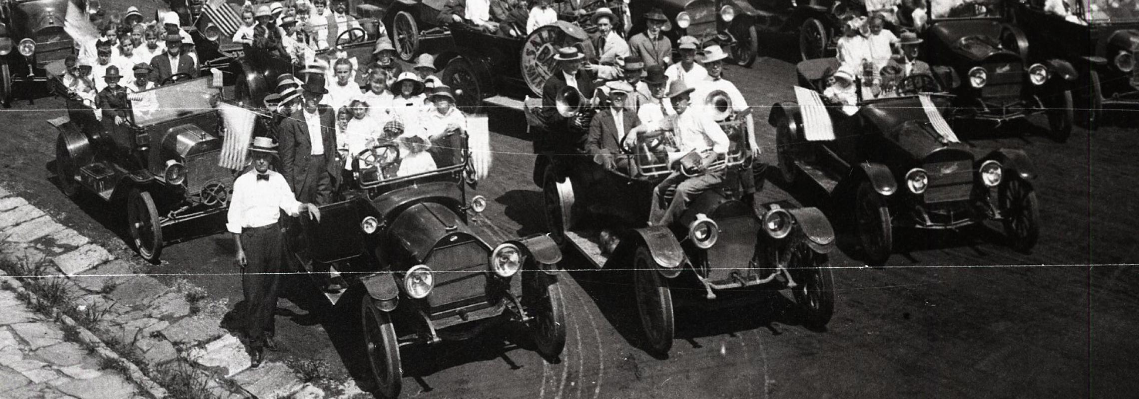
The arrival of the automobile brought with it a need for more and better-maintained roads, gas stations, garages, and parking locations. The good roads movement initiated the drive for highway reform. In 1921, the Missouri legislature passed the Centennial Road Law the provided for a statewide-interconnected highway system. Originally, the placement and construction of roads was in the hands of the individual counties. As the number of automobiles in Missouri continued to increase counties failed to keep pace with the poor road conditions and lack of roads to more rural areas. In 1911, the number of registered cars in Missouri numbered 16,000. That number jumped to over 150,000 in 1917.
Articles from Missouri Historical Review and Missouri Times
- Atherton, Lewis E. "Business Techniques in the Santa Fe Trade."
Missouri Historical Review 34 (April 1940): 335-341. - Austin, David C. "A Paying Proposition: The Jerome Bridge in Phelps County.”
Missouri Historical Review 94 (April 2000): 287-302. - Baker, James F. "The St. Louis and Suburban Streetcar Strike of 1900."
Missouri Historical Review 101 (July 2007): 226-245. - Bott, Emily Ann O’Neil "Joseph Murphy’s Contribution to the Development of the West."
Missouri Historical Review 47 (October 1952): 18-28. - Bowdern S.J., T.S. "Joseph LaBarge Steamboat Captain."
Missouri Historical Review 62 (July 1968): 449-470. - Branch, Mary Emerson "A Story Behind the Story of the Arkansas and Carondelet."
Missouri Historical Review 79 (April 1985): 313-331. - Britton, Sam. T. "Inefficiency of Water Transportation in Missouri."
Missouri Historical Review 14 (October 1919): 82-88. - Broadhead, G.C. "Early Missouri Roads."
Missouri Historical Review 8 (January 1914): 90-97. - Byran Jr., Charles W. "Aboard the Western in 1879."
Missouri Historical Review 59 (October 1964): 46-63. - Caldwell, Dorothy J. "Missouri’s Covered Bridges."
Missouri Historical Review 61 (January 1967): 229-237.
"Missouri’s National Historic Landmarks: Patee House."
Missouri Historical Review 66 (October 1971): 76-92. - Claycomb, William B. "John S. Jones: Farmer, Freighter, Frontier Promoter."
Missouri Historical Review 73 (July 1979): 434-450. - Dains, Mary K. "Midwestern River Steamboats: A Pictorial History."
Missouri Historical Review 66 (July 1972): 589-609.
"Steamboats of the 1850s-1860s: A Pictorial History."
Missouri Historical Review 67 (January 1973): 265-282. - Dalton, John Hall, Jr. "Dunklin County, Charles P. Chouteau, and the Courtship of the Iron Horse."
Missouri Historical Review 82 (October 1987): 71-96. - Doherty, Paul C. "The Columbia—Providence Plank Road."
Missouri Historical Review 57 (October 1962): 53-69. - Easton, David W. "Echoes of Indian Emigration."
Part I: Missouri Historical Review 8 (January 1914): 98-99.
Part II: Missouri Historical Review 8 (April 1914): 142-153.
Part III: Missouri Historical Review 8 (July 1914): 198-205. - Farr, William F. "Planks for Industry."
Missouri Historical Review 78 (January 1984): 137-143. - Flanagan, John T. "John Henton Carter, Alias ‘Commodore Rollingpin’."
Missouri Historical Review 63 (October 1968): 38-54. - Franklin, Lillie "Rocheport, Missouri, An Illustration of Economic Adjustment to Environment."
Missouri Historical Review 19 (October 1924): 3-11. - Gentry, North Todd "Plank Roads in Missouri."
Missouri Historical Review 31 (April 1937): 272-287. - Gerber, Rudolph J. "Old Woman River."
Missouri Historical Review 56 (July 1962): 328-346. - Grant, H. Roger "The Excelsior Springs Route: Life and Death of a Missouri Interurban."
Missouri Historical Review 65 (October 1970): 37-50. - Gregg, Kate L. "The History of Fort Osage."
Missouri Historical Review 34 (July 1940): 439-488. - Grinstead, H.F. "First Threshing Marching Across the Mountains."
Missouri Historical Review 8 (October 1913): 54-55. - Gubbels, Thomas J. "’No Longer a Barrier’: Bridging the Missouri River in Lafayette County."
Missouri Historical Review 97 (January 2003): 109-130. - Hartley, William G. and Fred E. Woods "Explosion of the Steamboat Saluda: Tragedy and Compassion at Lexington, Missouri, 1852."
Missouri Historical Review 99 (July 2005): 281-305. - Haswell, A.M. "The Building of a City – Springfield."
Missouri Historical Review 19 (April 1925): 397-403. - Hattervig, Eldon "Jefferson Landing: A Commercial Center of the Steamboat Era."
Missouri Historical Review 74 (April 1980): 277-299. - Hauck, Louise Platt "The Pony Express Celebration."
Missouri Historical Review 17 (July 1923): 435-439. - Holt, Edgar A. "Missouri River Transportation in the Expansion of the West."
Missouri Historical Review 20 (April 1926): 361-381. - Husband, Michael B. "Senator Lewis F. Linn and the Oregon Question."
Missouri Historical Review 66 (October 1971): 1-19. - Hutcheson, Virginia Sue "Cattle Drives in Missouri."
Missouri Historical Review 37 (April 1943): 286-296. - Kennedy, J.P. "Frederick W. Niedermeyer: A Missouri Aviator."
Missouri Historical Review 67 (July 1973): 548-575. - Langehenning, Laura "The Steamboat, Playground of St. Louis in the Fifties."
Missouri Historical Review 40 (January 1946): 205-214. - Lass, William E. "The Fate of Steamboats: A Case Study of the 1848 St. Louis Fleet."
Missouri Historical Review 96 (October 2001): 2-15. - Mattson, J. Stanley "Twain’s Last Months on the Mississippi."
Missouri Historical Review 62 (July 1968): 398-409. - McLarty, Vivian K. "The First Steamboats on the Missouri, Reminiscences of Captain W. D. Hubbell."
Missouri Historical Review 51 (July 1957): 373-381. - Morris, Leona S. "A Pictorial Glimpse of Life Abroad the Brownville, 1960s."
Missouri Historical Review 81 (April 1987): 309-327. - Moss, James E. "HO! For the Gold Mines of Montana. Up the Missouri in 1865. The Journal of William Gallaher."
Part I: Missouri Historical Review 57 (January 1963): 156-183.
Part II: Missouri Historical Review 57 (April 1963): 261-284. - Nichols, Roger L. "Martin Cantonment and American Expansion in the Missouri Valley.”
Missouri Historical Review 64 (October 1969): 1-17. - Popplewell, Frank S. "St. Joseph, Missouri, As A Center of the Cattle Trade."
Missouri Historical Review 32 (July 1938): 443-457. - Potts, Louis W. and George F.W. Hauck "Frontier Bridge Building: The Hannibal Bridge at Kansas City, 1867-1869."
Missouri Historical Review 89 (January 1995): 139-161. - Pritchard, J.A. "Diary of a Journey from Kentucky to California, 1849."
Missouri Historical Review 18 (July 1924): 535-545. - Reilly, Thomas "Tom Benoist: Pioneer Early Bird of St. Louis."
Missouri Historical Review 92 (October 1997): 45-60. - Renner, G.K. "The Kansas City Meat Packing Industry Before 1900."
Missouri Historical Review 55 (October 1960): 18-29. - Richardson, Kelli "Caissons and Calamity: The Tragedy and Triumph of Eads Bridge."
Missouri Historical Review 92 (October 1997): 18-26. - Riegel, R. E. "The Southwestern Pool."
Missouri Historical Review 19 (October 1924): 12-24. - Schaaf, Ida M. "The First Roads West of the Mississippi."
Missouri Historical Review 29 (January 1935): 92-99. - Schnell, J. Christopher "Chicago Versus St. Louis: A Reassessment of the Great Rivalry."
Missouri Historical Review 71 (April 1977): 245-265. - Schultz, Gerard "Steamboat Navigation on the Osage River Before the Civil War."
Missouri Historical Review 29 (April 1935): 175-185. - Sculle, Keith A. "’Our Company Feels that the Ozarks are a Good Investment: The Pierce Pennant Tavern System."
Missouri Historical Review 93 (April 1999): 293-307. - Shoemaker, Floyd C. "The Louisiana Purchase, 1803, and the Transfer of Upper Louisiana to the United States, 1804."
Missouri Historical Review 48 (October 1953): 1-22.
"Pike County."
Missouri Historical Review 52 (July 1958): 313-324.
"Osceola, Land of Osage River Lore."
Missouri Historical Review 54 (July 1960): 327-334. - Shoemaker, Floyd C. and Ruby M. Robins "The Butterfield Overland Mail, 1858-1861, and its Centennial Observance in Missouri."
Missouri Historical Review 52 (April 1958): 218-234. - Shortridge, James R. "’Edward Miller’s Town: The Reconceptualization of Pleasant Hill by the Pacific Railroad of Missouri.’"
Missouri Historical Review 101 (July 2007): 205-225. - SHSMO Staff "Sesquicentennial Issue 1821-1971."
Missouri Historical Review 65 (July 1971): 403-545. - Smith, Haden "Covered Bridges: Sturdy Relics of Missouri."
Missouri Historical Review 74 (January 1980): 123-136. - Talbut, Mary Harriet "The Bridge that Spanned the Great Depression."
Missouri Historical Review 88 (January 1994): 176-188. - Toole, Robert C. "Steamboats at the Bar. The Keokuk Northern Line, 1873-1888."
Missouri Historical Review 59 (April 1965): 302-323. - Traylor, Richard C. "Pulling Missouri Out of the Mud: Highway Politics, the Centennial Road Law, and the Problems of Progressive Identity."
Missouri Historical Review 98 (October 2003): 47-68. - Trexler, H.A. "Missouri – Montana Highways."
Part I: Missouri Historical Review 12 (January 1918): 67-80.
Part II: Missouri Historical Review 12 (April 1918): 145-162. - Wallace, Agnes "The Wiggins Ferry Monopoly."
Missouri Historical Review 42 (October 1947): 1-19. - Welsh, Donald H. "The Butterfield Overland Mail Centennial in Missouri."
Missouri Historical Review 53 (January 1959): 132-140.
"Travel by Stage on the Boonslick Road."
Missouri Historical Review 54 (July 1960): 335-340. - White, Edward J. "A Century of Transportation in Missouri."
Missouri Historical Review 15 (October 1920): 126-162. - Wood, Martha May "Traces in Early Missouri, 1700-1804."
Missouri Historical Review 38 (October 1943): 21-24. - Zobrist, Benedict K. "Railroad Men Versus Steamboat Men: The First Bridging of the Mississippi River."
Missouri Historical Review 59 (January 1965): 159-172.
Catalog
Many of the State Historical Society’s holdings are included in the SHSMO online catalog. The State Historical Society holds numerous books on the history of transportation in Missouri, the Midwest, and the United States generally. Use the term "transportation" or specify a mode of transportation such as "trains". For a more specific search, simply add the subject term “Missouri” to your search.
Digital Collections
Historic Missourian Biographies
- Moses Austin - Austin was an American merchant and lead miner. He built communities on the frontiers of Virginia and Missouri, and laid plans for the colonization of Texas. He improved transportation, trade links, and mining methods in these areas, and brought national attention to their mineral wealth.
- Louis S. Curtiss - Curtiss was a prominent Kansas City architect known for his innovative buildings. In 1905 Curtiss established a fruitful relationship with the Santa Fe Railroad, designing a number of train depots and buildings for the company. This led to him designing hotels and restaurants for the Fred Harvey Company, which specialized in providing dining and lodging services to rail travelers across the United States.
- James Buchanan Eads - Eads spent his life solving difficult engineering problems that made life on and around the Mississippi River safer and more convenient. His most important engineering achievement was designing and building the first bridge to cross the Mississippi River at St. Louis. His bridge provided a crucial connection between Missouri and eastern cities.
- Joseph LaBarge - Joseph LaBarge was a famous steamboat captain on the Missouri River. During his fifty-year career, he never lost a boat. LaBarge's career on the river mirrored the rise and decline of the steamboat industry as interstate river commerce grew until it was eclipsed by the emerging railroad industry.
- James Sidney Rollins - As a businessman, Rollins was involved in agriculture, real estate, and improving railroad and river transportation. He helped establish the North Missouri Railroad Company and was involved in numerous other railroad ventures.
- Harriett Woods - Woods was the first female lieutenant governor of Missouri, a Democratic politician, and an advocate for women's rights. In 1973, she was appointed to the State Highway Commission and the State Transportation Committee.
Manuscripts
The State Historical Society of Missouri's manuscript collections contain materials concerning roads, railroads, waterways, airways, and other modes of travel; papers of individuals in the transportation industry; records of freighting and other types of transportation companies; professional and trade organization records; public transportation; and tourism.
Oral Histories
- Maxwell Williams - Williams' numerous experiences in southeast Missouri have included leading civic groups concerned with transportation and educational improvements.